There are countless things I need to learn more about before we go cruising, and one of those many things is weather forecasting and routing. Before today, I thought I comprehended some of the basics of pressure, fronts, and the like, but knew I would not be comfortable making decisions about passages and routing with my current knowledge level. Moreover, I knew I was even more clueless regarding the methods of receiving information while we are at sea, or at least away from the internet. But I did not realize just how profound my lack of understanding was (though I did manage to break the world record in this weather routing game!).
Over the past couple years I have bought a few books on weather forecasting for cruisers, but have not been able to muster much excitement about them. To me, they all seem fairly boring and fairly incomprehensible without the benefit of actual weather data to play around with while reading them. But a recent article by Bill Biewenga, “Free Online Weather Tools,” in Blue Water Sailing – a magazine we get not one, but two copies of after signing up for a free subscription at the boat show – finally sparked my interest. Not only does the article deliver sites for free weather information, but Biewenga also suggests that cruisers should chart the weather in future cruising areas for a few seasons so that they can get a sense of how accurate the various forecasts are, how often the weather in a region departs from the seasonal norm, and how weather patterns and systems develop and evolve in a given region. At last, I figured I had found something that could give me some hands on experience to motivate and help me learn. I had visions of spending an hour or two in front of the computer acquainting myself with the different maps and forecasts and then figure out an easy way to compile and analyze this information over time. It did not take me long to realize it was going to take a bit more than that to really comprehend any of it. For starters, the first site I went to, the National Weather Service’s marine charts had dozens of charts for the north Atlantic alone. At this point I do not even know whether I should be looking at the, for instance, surface charts, which of the 17 of those I should be looking at if indeed surface charts are something I should be eyeing, and how to interpret the chart itself. Needless to say, I was overwhelmed by it all.
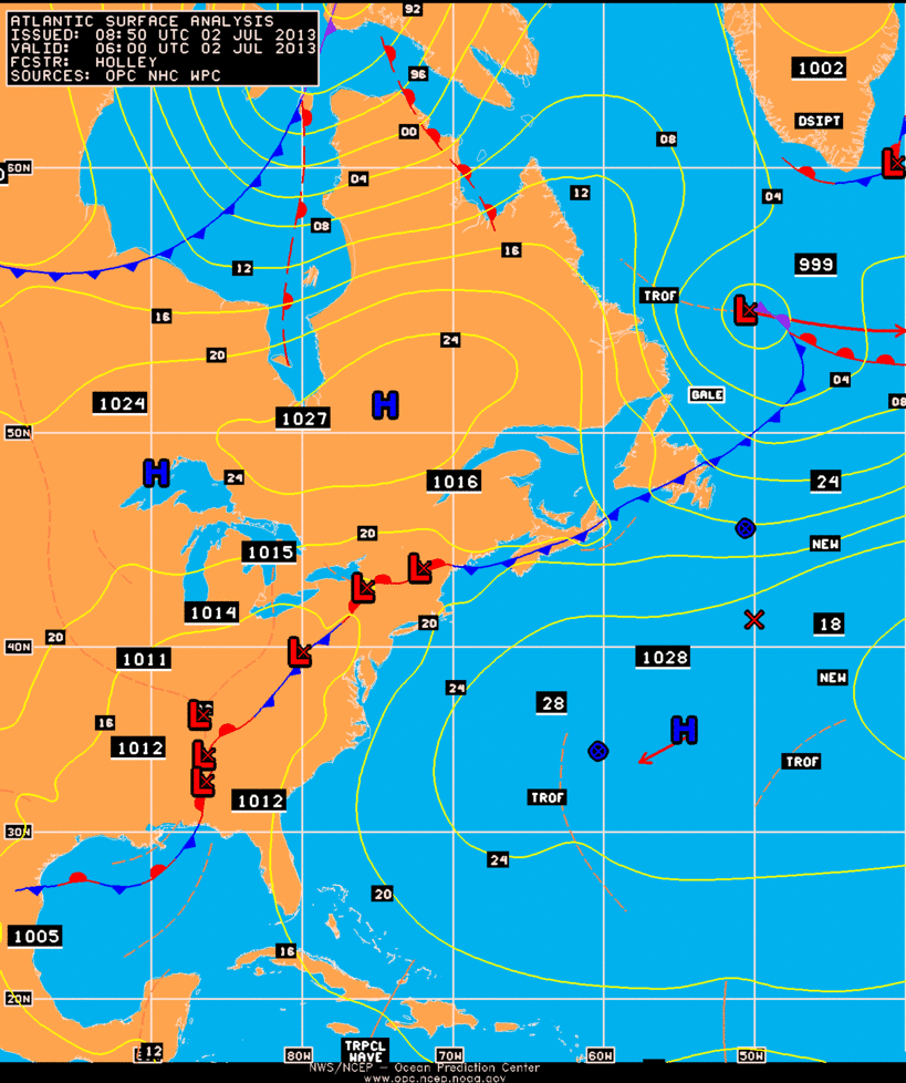
North Atlantic Surface Analysis Chart
So, I started digging around looking for a place to get started learning. The problem I encountered, however, is that there is so much information out there, and much of it is far beyond my current comprehension. A lot of the material looks really interesting and useful (check out all the modules on this site, for instance), but I need to get at the basics first.
Finally, I found Lyn and Larry Pardey’s “Weather Routing Advice to Cruisers” on their website that provided some very sound and basic advice on this topic. The post is pithy and worth reading, but the short of it is that they recommend Alan Watts’s Instant Weather Forecasting
, a barometer, basic observations, and a good deal of practice. All of that sounds like a good place to start, so I will be ordering the book soon and making sure our barometer (a wonderful wedding present from Dan and Kathleen) is properly adjusted.
I also found a basic page on reading and interpreting surface analysis charts, which helps me understand some of the more esoteric symbols on weather charts. Finally – because I really need to stop looking at all this weather stuff and go to bed – is NOAA’s user guide for their Ocean Prediction Center’s charts.
I will be delving into all this and more in the coming weeks and months, and I will be sure to write additional posts as I get a better handle on not just weather and accessing weather information, but also, more simply, how best to learn about these things. Hopefully in a few weeks I will look back at this post and at least have a better handle on what exactly I need to learn and how I can go about learning it. And hopefully I can also begin charting the forecasts and weather as Biewenga suggested. What I am now sure of is that I will be learning about weather from now until we stop cruising, which is really how it should be.