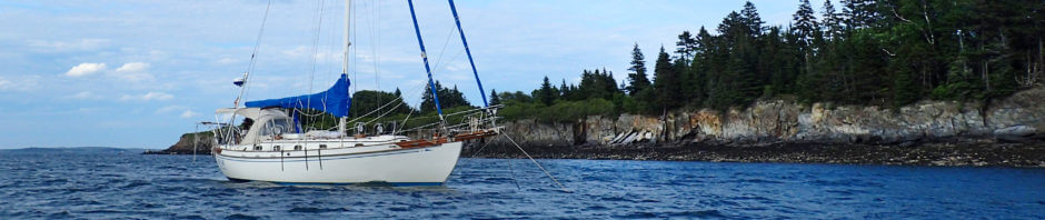
We pulled into the St. Mary’s River, which divides Florida and Georgia last Friday, September 5th, having left Norfolk, Virginia on August 16th. While we did not enter Florida, we covered the core of the Intracoastal Waterway during the trip. Of course, I am going to share some of our experiences along the way. But, knowing that a few hundred boats will be covering this route over the next couple months, I figured I would try to organize most of my posts about the ICW in such a way that will make them easier to use as a guide and reference. Hence, I will provide some general comments about the ICW in this post and then add additional links and posts as I write up the trip.
The ICW from Norfolk to Florida does not share much in common with the ICW of the Chesapeake Bay and points north. Below Norfolk, most of the ICW travels along creeks, rivers, cuts, and canals with only the occasional open water stretch through various sounds and bays. Whereas on the Chesapeake or Long Island Sound, we could sail good portions of the route if we chose or simply head out of the channel to avoid other traffic without worrying too much about depth, traveling the southern portion of the ICW we mostly motored and had to be vigilant about navigating the channel; there were almost no stretches where we just set the autopilot and did not touch the wheel again for more than a couple minutes at a time. Making sure we were in the channel, anticipating tide, and dealing with other navigational issues like bridges and obstructions occupied a huge part of our – at least, my – time and mental energy.
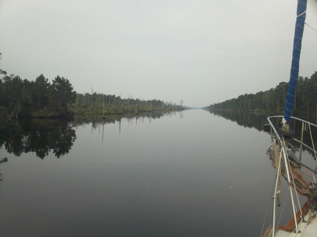
The Alligator – Pungo River Canal
To deal with the navigational challenges, I developed a routine that worked well. In the evening, I would pull out Skipper Bob’s Anchorages along the Intracoastal Waterway
and begin planning out the following day. Using ActiveCaptain, I would identify shoaling and obstructions, writing into Skipper Bob’s book any potential issues and highlighting key concerns such as bridges that needed opening and places where we needed to watch for depth (here is a link to all our notes), though some hazards noted on ActiveCaptain are not entirely accurate. Underway, we would have old Maptech paper chart
(from back in 1997, which had its own perils and, surprisingly, benefits), our annotated Skipper Bob’s Anchorages, the binoculars (and occasionally range bearing compass), and, mainly for the non-navigational, interesting information it provided, Dozier’s Waterway Guide
out in the cockpit. Our chartplotter would also be on down below at the navigation station (we do not have a working chartplotter at the helm, which I will certainly explain in a later post). Consequently, before we even started out for the day, we knew where we were planning on anchoring, had some bail-out plans should weather or other issues slow us down, understood where the difficult sections would be and what to watch out for in those portions, and had all the references we needed in front of us.
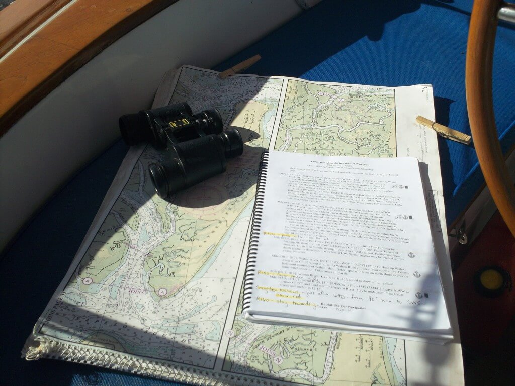
Our chart, Skipper Bob’s, and the binoculars
While transiting the ICW, I formulated a sort of hierarchy that structured how I would handle the navigational issues that we anticipated and those that popped up along the way. This hierarchy is not rocket science, and I imagine that any safe boater who knows what they are doing on the water has something like this in the back of their mind even if it is not so rigidly laid out as mine is here. And, actually, mine is a lot more fluid in practice as well. I only systematized it in this way to try to come up with a straightforward procedure for my Dad to follow while he was aboard.
- Use your head. This mainly means two things. First, if something does not appear as you think it should, start figuring out why. Second, in the absence of other information, apply basic principles to figure out which direction we should be heading, where the deep water is, etc.
- Use your eyes. Always visually confirm the number of buoys and presence of other landmarks (use the binoculars to look ahead!). Also, do not just look to the marks in front of you, but also look at the ones behind; in strong cross-currents you will be pushed out of the channel and not notice it if you are not paying attention to the buoys behind as well as in front. Moreover, if you see something that is not anticipated – a buoy in an unexpected place, a shoal intruding on the channel – believe your eyes and use your head (#1) to figure out what is going on.
- Use the channel markers. If your charts, chartplotter, ActiveCaptain information, etc., tells you that a marker should be in one place and it is not, believe the physical markers that are out there in the real world, not the 1997 charts, last year’s chip on the plotter, or crowdsourced data, all of which is probably out of date compared to the markers, especially the cans and nuns, that the USCG and Corps can and do move around.
- Use the chart. Even though we had a 1997 chart that was horribly out of date, I believe in using paper charts because they force you to orient yourself. A chartplotter, with its certainty, can lull you into believing you know exactly what is happening. A paper chart requires that you interact with the world around you, helping to remind you of the larger context and forcing you to take in additional information.
- Use the chartplotter. While I would never rely completely on the chartplotter, there are times when it provides additional pieces of information that can help you make good decisions. For instance, when the depth sounder started to buzz at 6 feet (for our 5’8” draft) and the other sources of information (common sense, charts, ActiveCaptain, etc.) could not help us locate a little more water, I would often – slowing the boat down to bare steerage – go below and have a look at where the chartplotter said the deeper water was. However, in my opinion, the chartplotter should never be used for primary navigation.
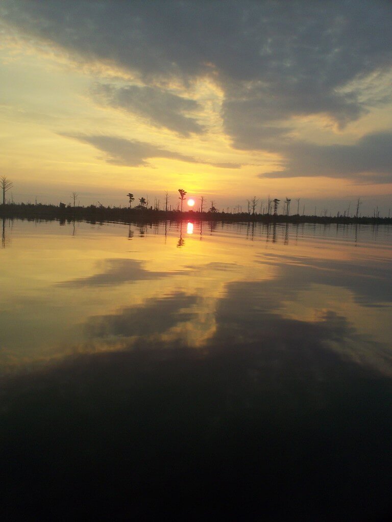
Sunset somewhere along the ICW
Using these principles, we made through these 700 miles of the ICW without incident. And, there were only three places where we found, with our 5’8” draft, that we really needed to wait for some tide to transit (the two miles north of the Ben Sawyer bridge, Fields Cut, and Hell Gate). Even where some people on ActiveCaptain found the bottom or thought there was less than six feet of water at low tide, we always found there was ample depth, as long as you were really in the channel.


Enjoyed reading this. It will probably be next spring before I go up the ditch, but all information is handy! I will be heading to Lake Erie, so will be going more north than you, then into the Erie Canal back to the Lake. Come fall, will reverse course.
That should be a great trip, Helen. We are still in the planning stages, but are currently thinking we will be making our way north to Maine next summer. Maybe we will see you along the way!
Thanks for this info Jeff. I have been checking out many of your posts regarding the ICW. We are transiting from Maine and currently in Oriental.
I am really glad to hear that you are enjoying the posts. I wish I was with you down there in Oriental, having a coffee at the Bean and just reveling in the atmosphere of that great cruising community (and enjoying the warmer weather). What kind of boat are you on and what are your immediate plans? Thanks for reading. Fair winds.